Tipaza
Tipaza
- Code:
- 42
- Name in arabic:
- تيبازة
- Name in english:
- Tipaza
- Name in berber:
- ⵜⴰⵏⴻⴱⵟⵉⵜ ⵏ ⵜⵉⴼⵣⴰ
- Phone Code:
- 024
- Zip code:
- 42000
- Population:
- 591 010 hab. (2008)
- Area :
- 2 166 km2
Presentation of the wilaya
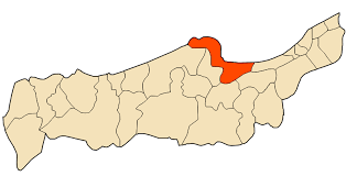
The wilaya of Tipaza (in Arabic : ولاية تيبازة ; in Berber : ⵜⴰⵏⴻⴱⵟⵉⵜ ⵏ ⵜⵉⴼⵣⴰ , Tanebḍit n Tifza ) is a partially Berber-speaking Algerian wilaya located 68 km west of the capital Algiers . The capital of the wilaya is Tipaza .
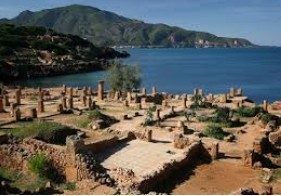
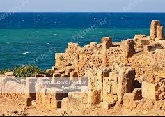
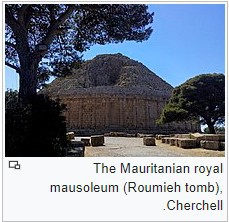
The presence of the sea, the reliefs of Chenoua and Dahra give a particular landscape and of tourist interest. Numerous Punic, Roman, Christian and Muslim remains attest to the rich history of this region. The population speaks dialectal Arabic and Berber in its local variety called haqbaylith or Chenoui specific to the Dahra region.
Daïras and Communes making up the Wilaya
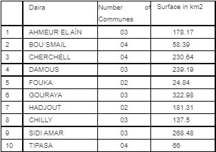
GEOGRAPHICAL SITUATION (Relief - Climate, etc.)
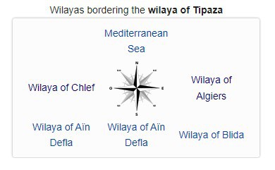
The wilaya of Tipaza is located north of the central Tell . It is geographically bordered:
- The Mediterranean Sea to the north ;
- The wilaya of Algiers to the east ;
- The wilaya of Blida in the south-east ;
- The wilaya of Aïn Defla in the south ;
- The wilaya of Chlef in the west.
relief:
The territory of the wilaya of Tipaza covers an area of 1,707 km 2 which is divided into :
- Mountains : 336 km 2 ;
- Hills and foothills : 577 km 2 ;
- Plains : 611 km 2 ;
- Others : 183 km 2 .
In the north-west of the Wilaya, the mountain range comprising the Blidièen Atlas gives way to two important groups :
In the north-east, the Mitidja extends mainly over the wilaya of Blida and is limited to the level of the wilaya of Tipasa by the bead formed by the Sahel (Average Altitude 230 m).
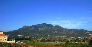
In the north of the Sahel, a coastal strip shows a narrowing and a gradual rise from east to west until it disappears in places in Tipasa and in the Dairas of Cherchell and Sidi Amar where the very rugged relief around Mount Chenoua presents significant escarpments by the sea.
Weather
The wilaya of Tipaza is located in a single bioclimatic floor Subdivided into two variants :
- The sub-humid stage Characterized by a mild winter in the northern part.
- The sub-humid stage Characterized by a warm winter in the southern part.
Winds have different frequencies throughout the year ; the most dominant are southerly and westerly ; as for Sirocco , it is rarely recorded during the winter. On the other hand, frosts are strongly influenced by altitude.
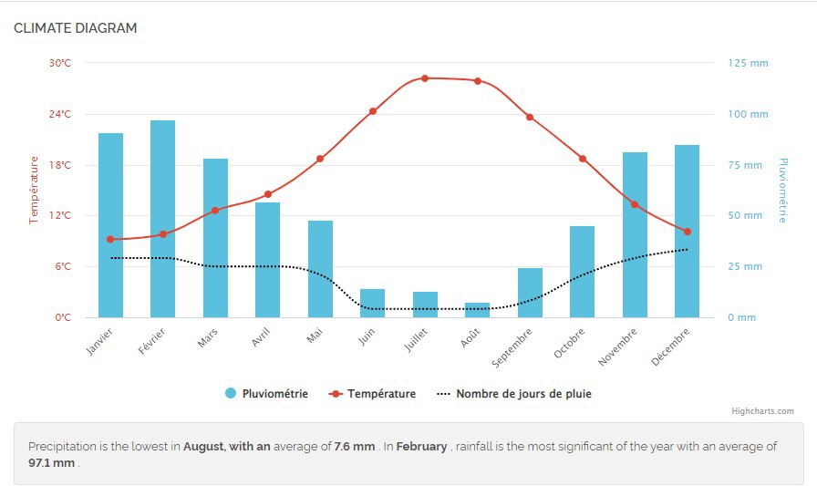
The average precipitations recorded by the Merad station show an average annual rainfall of 600 mm during the period 1978-2004.
Temperatures vary between 33 ° C for the hot summer months (July, August), to 5.7 ° C for the colder months (December to February).
NATURAL POTENTIALITIES
Forests
With an area of 40 375 ha , forests and scrub occupy 23.6 % of the territory of the wilaya of Tipaza (170 700 ha ). Forests are unevenly distributed across the province, about 27 415 ha , or 60 % of the total are concentrated in the western region ( Damus , Cherchell , Gouraya , Sidi Amar ). The land use by essence gives a distribution where the Aleppo pine is the most widespread with 56 %, followed by the holm oak at 17 %. As for the cork oak, the area of which is much more on the west side of the wilaya, it occupies 7 % of the total forest area of the wilaya.
ECONOMIC POTENTIALITIES
Agricultural potentials
The potential ground of the wilaya of Tipaza is 72 929 ha, 64 772 ha of agricultural area (UAA). The irrigated area is estimated at end 2004 to 12 215 ha is an irrigation rate of 18.9 % compared to the UAA. The lands are delimited in three major agro-climatic zones ;
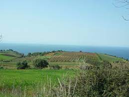
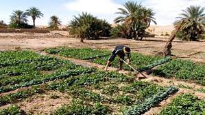
- The first being the Sahel which includes all the UAA of the coast whose vocation is essentially market gardening ;
- The second, called the Mitidja plain, constitutes the future cradle of intensive agriculture with the filling of the irrigated perimeter. This scope covers an area of 14 000 ha.
The main crops in this area are citrus, fruit trees, potatoes, fodder and cereals. It will also be the future dairy basin of Mitidja West.
- The third area is formed by a mountainous area. It is made up of the Dahra , Zaccar and Chenoua mountains . It is particularly favorable to rustic arboriculture as well as to local cattle and goat breeding.
The crops cultivated on the lands of the wilaya vary according to the nature of the soil. They are dominated by the following cultures :
- Cereals : 19,866 ha (30.7 %) ;
- Market gardens : 14,623 ha (22.6 %) ;
- Arboriculture : 8,823 ha (13.7 %) ;
- Forages : 6,103 ha (9.5 %) ;
- Viticulture : 4,133 ha (6.4 %) ;
- Dried vegetables : 398 ha (0.7 %) ;
- Industrial crops : 455 ha (0.7 %).
ECONOMIC, ADMINISTRATIVE AND SOCIAL INFRASTRUCTURES
Hydraulic
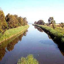
The wilaya of Tipaza has an important hydraulic network. From east to west :
- Oued Mazafran ;
- Oued El Hachem ;
- Oued Djer ;
- Oued Damous.
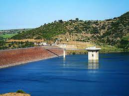
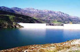
This wilaya includes the following dams :
- Boukourdane dam ;
- Taourira dam ;
- Kef Eddir Dam
Road network

Maritime network:
Five (05) ports located at: Gouraya, Cherchell, Bou Haroun, Khemisti and Tipasa. The port of Gouraya, through its development and extension, is called upon to play a driving role in development throughout the western zone of the wilaya.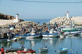
Rail network:
A project to build an electrified railway line connecting ZERALDA, west of Algiers, to Gouraya in the wilaya of Tipaza over 90 km is under study. This line will be connected to the rail network in the suburbs of Algiers.
Education :
The wilaya has primary schools, CEMs and high schools
Training
The vocational training sector has a national vocational training institute (INSFP) located in Hadjout and 7 CFPAs. Residential training : The total theoretical capacity of the wilaya in residential training (CFPA) is estimated at 2,750 training positions with actual training staff of 3,820 trainees including 2,179 girls, i.e. a female rate of 57 % with 1,017 graduates. and 3,989 apprentices during the 2004/2005 school year.
Health
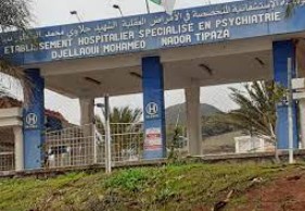
The wilaya has the following hospitals :
- Lakhdar Bouchama Hospital
- Dr Yahia Fares Hospital.
- Koubaili Mohamed Erabat Hospital.
- Gouraïa hospital.
TOURIST ACTIVITIES
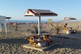
The wilaya of Tipasa has a tourist potential and an important historical heritage. The coast extends over nearly 123 km with the existence of 51 beaches, 39 of which are open for swimming in addition to numerous coves, bays, and other cliffs offering undeniable tourist possibilities. These sectors constitute a significant asset for the socio-economic development of the wilaya because a considerable influx is recorded each year.
To this end, the wilaya of Tipasa has the following infrastructures :
- 2 tourist complexes with a total capacity of 2,420 beds ;
- 4 private hotels with a capacity of 130 beds ;
- 3 classified hotels with a capacity of 2,420 beds ;
- 4 unclassified hotels with a capacity of 130 beds ;
- 1 youth hostel (Cherchell) with a capacity of 70 beds.
 ,
, 
Hai 60 participatory housing (in front of the covered market), Tipaza, Algeria
 Contact details of the Chamber of Commerce and Industry of
Tipaza
CCIC / Chenoua Chamber of Commerce and Industry
- Address:
- Hai 60 participatory housing (in front of the covered market), Tipaza, Algeria
- Email:
-
cci-chenoua@caci.dz
- Mobile:
- There is no primary mobile phone
- Landline number:
-
024 37 00 90
- Fax:
-
024 37 01 00
024 37 37 37
- Viber:
- There is no viber account
- Work hours:
- We don't have this information.
